Maps
Module Overview
- Topic: Maps
- Time Period: 1832-1986
- Keyword(s): Maps, Transportation, Topography, Map symbols, Ohio, United States
- Grade Level(s): Grades 1-3
- Learning Standard(s):
- Ohio Social Studies: Grade 1; Content Standards 2, 4
- Ohio Social Studies: Grade 2; Content Standards 2, 5
- Ohio Social Studies: Grade 3; Content Standards 2, 3
Maps show us how the world looks today and how it looked in the past. They help us locate and identify places like cities and states; find geographic features like lakes and mountains; and see where places are in relationship to others.
Three common types of maps include political, physical, and road. Political maps show state and national boundaries without topographic features as well as location of cities. Physical maps show physical features of a place, including rivers, mountains, forests and lakes, through use of different colors (e.g. water is blue, mountains are brown). Road maps show roads, highways or railroads in an area and are typically used for direction purposes. (Source: https://mocomi.com/types-of-maps/).
You can interpret a map by using a title, key (symbols), alphanumeric grid and cardinal directions. A map’s title explains the map’s purpose (Ex. What area of the world is the map showing?). Its key explains what symbols and colors on a map mean (Ex. Cities of different population size may be denoted by different shapes, colors can show elevation and natural features, and lines can indicate political boundaries.). An alphanumeric grid can help find specific areas on a map (Ex. Some maps list locations you can find on them, including alphanumeric coordinates that allow you to find the place of interest on the map.). Cardinal directions demonstrate where one place is in relationship to another (Ex. North, east, south, west).
After the primary source items, you will find an Additional Resources list and a Teaching Guide that includes discussion questions and classroom activities.
Maps Set Sections And Materials
Primary Source Set
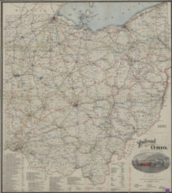
1901 Railroad Map of Ohio
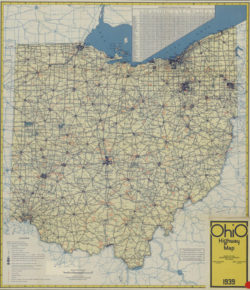
1939 Ohio Highway Map
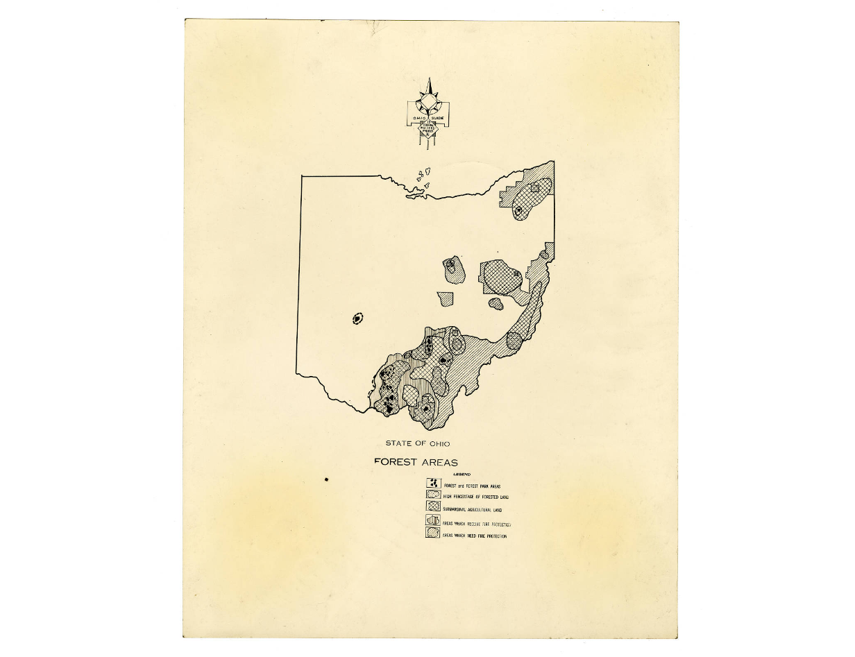
Map of Ohio showing the forested areas
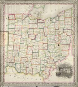
1857 Ohio Railroad Map
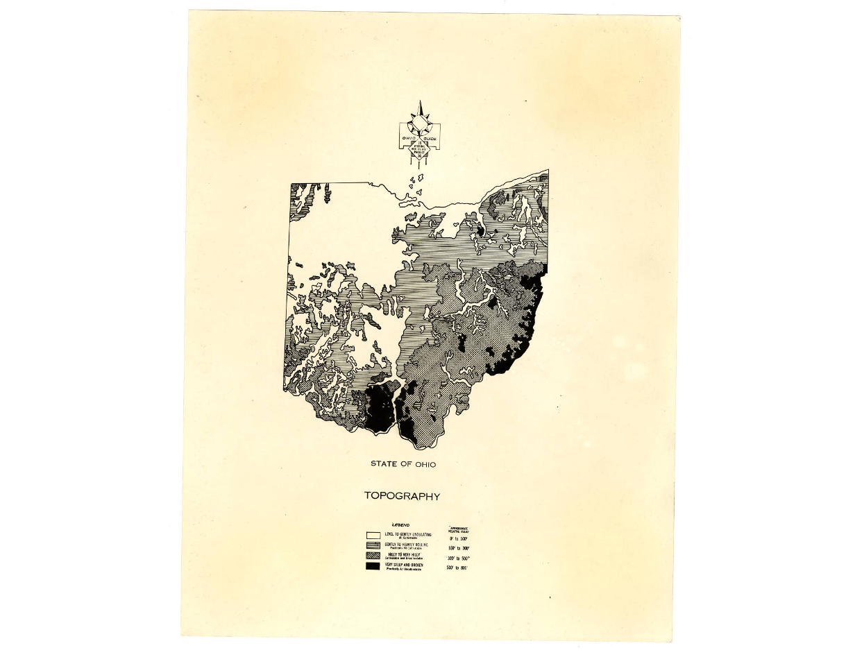
Map of Ohio showing the topography of the state
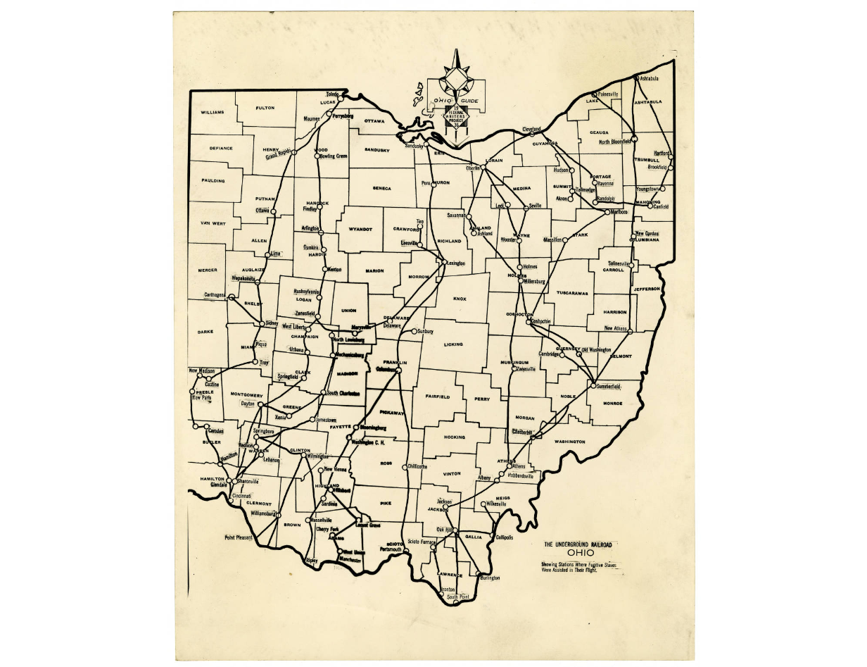
Underground Railroad Routes in Ohio map
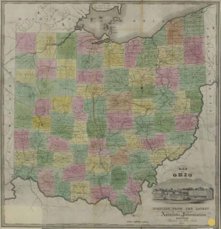
1832 Map of Ohio
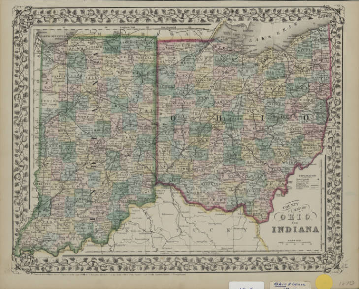
1870 County Map of Ohio and Indiana
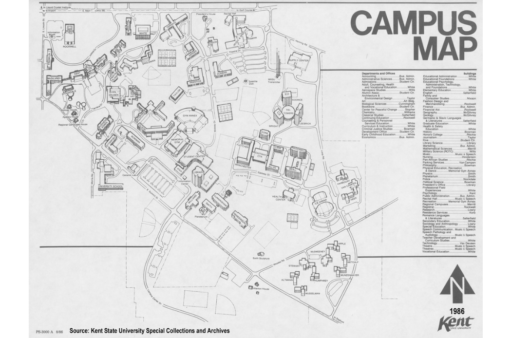
Kent State University campus map, 1986
Zanesville, Ohio 1936 Map
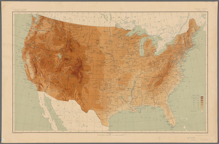
United States relief map
Contributed by Lionel Pincus and Princess Firyal Map Division. The New York Public Library
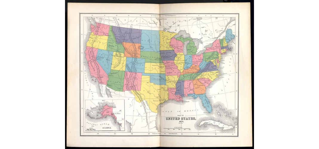
Map VI United States 1877
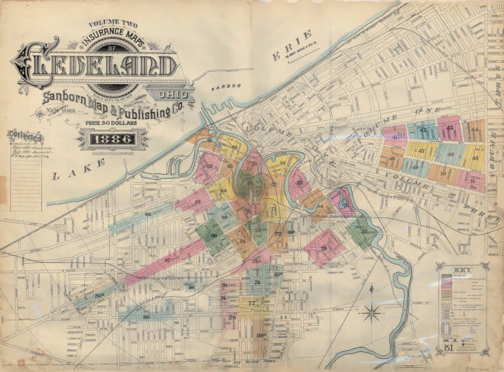
Insurance maps of Cleveland, Ohio (Sanborn, 1886) V. 2
Additional Resources
- Analyze a Map Worksheet, National Archives and Records Administration (PDF): Worksheet for novice/younger/ESL students asks general questions to explore and analyze map.
- Analyze a Map Worksheet, National Archives and Records Administration (PDF): Worksheet for intermediate/secondary students asks general questions to explore and analyze maps.
- Getting Started with Maps in the Classroom, Library of Congress: Blog post provides ideas and resources for using maps in the classroom.
- Historic Maps in K-12 Classrooms, The Newberry Library: A set of maps and related activities to help K-12 teachers use maps in the classroom. Covers several topics and lesson plans designed to accommodate four age groups.
- Introduction to the Sanborn Map Collection, Library of Congress: Overview of Sanborn maps, including what they are and how to interpret them.
- Teaching with Maps, National Education Association: Lesson plans, classroom activities and resources featuring maps. Covers grades K-12.
Teaching Guide
This guide will serve to outline some possible ways to interact with the digital content and has suggestions to have students pull information from the examples listed above.
Discussion Questions
- Compare the 1901 Railroad Map of Ohio, 1939 Ohio Highway Map and Map of Ohio showing the forested areas. What information do they provide? How are they similar? How are they different? Describe a time when you would use one of these maps over another.
- Compare the 1832 Map of Ohio and the 1857 Ohio Railroad Map. Are there locations on one map that aren’t on another? Which ones, and why do you think that is?
- What does the Underground Railroad Routes in Ohio map tell you about the paths runaway slaves took to reach freedom in the northern United States or Canada? Which areas of the state were the most active?
- Look at the 1870 County Map of Ohio and Indiana and find the city or county where you live. Describe where your city or county is in relationship to Cleveland, Cincinnati, Columbus, Toledo and/or Marietta using cardinal directions.
- How does the Kent State University campus map, 1986 differ from some of the other maps in this primary source set?
- View the Zanesville, Ohio 1936 map. What can you learn from a city map versus a state or country map? What are the specific things, including points of interest, you can learn about Zanesville from this map?
- Is the Map of Ohio showing the topography of the state a physical or political map? What does it show you about Ohio?
- What do the different colors on the United States relief map mean? How do you know this? How does Ohio compare with Florida and Colorado?
- Does the Map VI United States 1877 look different from modern maps of the United States? How? Why do you think that is?
- Review the Insurance maps of Cleveland, Ohio (Sanborn, 1886) V. 2. What do the different colors indicate? Why would this information be important or helpful for insurance companies?
Download Discussion Questions (PDF)
Classroom Activities
- Have students draw maps of a location of their choosing (e.g. bedroom, house, neighborhood, school, state, etc.). Depending on their grade level, ask them to include cardinal directions, a key, and alphanumeric grid that allows them to describe and/or point to different areas in their map. The instructor may choose to create a classroom map either with the class or before class as an example handout.
- Have students select a map and either independently or in groups, complete the NARA Analyze a Map worksheet. Extension: Ask students to find maps on DPLA not included in primary source set to analyze.
- Ask students to review each map and identify its type: political, physical, road, other. Ask them to explain the reasoning behind their answer.